Works with MSFS 2024: Yes – Compatible
Works with MSFS 2020: Yes – Native
Important
Covers a large area, might result in visual issues with other addons at certain spots. Use at your own risk.
Covers a large area, might result in visual issues with other addons at certain spots. Use at your own risk.
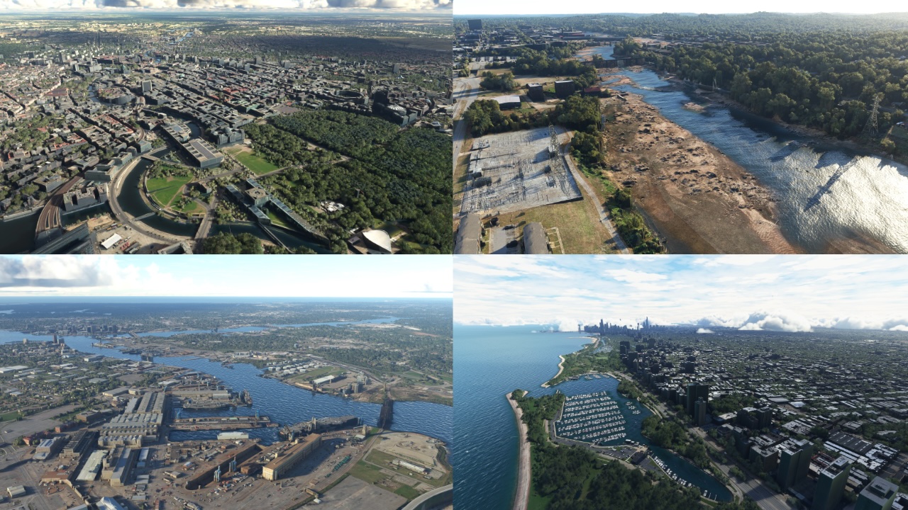
Introducing Enhanced Photogrammetry: Elevating Your Microsoft Flight Simulator Experience
Embark on a journey to enhance your Microsoft Flight Simulator experience with Enhanced Photogrammetry. The goal is to address the imperfections in the game and reveal the hidden beauty that lies beneath the surface of oceans, rivers, and lakes.
What Enhanced Photogrammetry brings to your MSFS experience:
… read moreUnveiling Hidden Beauty: Say farewell to submerged bridges, marinas, and beaches. All structures and objects along the water’s edge, have been meticulously exposed, including marinas and stunning bridges.
Clearing Waterways: No more ships and docks disappearing underwater. Our add-on ensures that you can see them clearly, making your flights and explorations in the game more realistic.
Enhancing Visuals: We’ve cleaned up bridges and ships by removing excess vegetation that used to obscure their appearance, and removed water from small canals.
A couple of things we haven’t tackled yet:
Private Piers and Italy: We’re aware that private piers along the Gulf and Atlantic coasts of the US still need attention. And Italy isn’t included in this update because the “Italian Coastline” add-on has already addressed it. We’re actively working on a solution for both.
The Thames Challenge: Due to the complexities of the Thames River, we can’t make major improvements without causing visual issues. But rest assured, we’re exploring solutions for this as well.
Prepare to take your Microsoft Flight Simulator experience to new heights with Enhanced Photogrammetry. Stay tuned for its release and get ready for fantastic flights and adventures!
New comments disabled. Please follow our Help page on any problems or contact us for any suggestions.
I’m curious is this is truly global. That’s quite the claim considering there are 10’s of thousands of miles of shoreline throughout the world.
fps impact?
None. But you mat end up with visual issue/s at certain locals. See post below as an example.
1.0.5 is the current version.
not sure where you got this, 1.0.4 is the latest atm.
good way to demo before i buy it, looks promising
FYI….With this add on you may see no water under bridge/s and bridges/s with a wall along the bottom of them. I had this with Vancouver BC. I was also using Samscene Vancouver, RK Bridger. What remedied the issue? I had to remove the Asobo Canada PG (Content manger) and remove this add on as well. Now the bridges in downtown Vancouver appear correctly.
Update to the above post….
Found the following post..
If used with RK bridger Vancouver the downtown bridges will have an issue. The following statement is from developer…”Yes, if you use both my add-on and RKBridger’s, you will see dry land under those bridges. I will release in the future a free add-on to fix this
Is this compatible with Dreamscenery Region fix?
Hi, I’m the developer of Enhanced Photogrammetry. We do the same exact thing, maybe I do more, but I released 1 add-on with every photogrammetric city present in the game, while they release one city at a time. Mine is 14.99 for the 450+ cities, they sell 1 city for 4.99
Will 1.0.3 be SU 15 ready?
new version 1.0.3
https://www.facebook.com/PjCoastline/
What parts of the world does this cover?
Everything are crop fields (at least Spain) lmfao
Hi Drop the files in Community?
always unless mentioned otherwise, see the FAQ
Worth?
Cities updated:
CU #5 The Hague
CU #5 Brussels
CU #5 Košice
CU #5 Zagreb
CU #5 Cádiz
WU #15 Aarhus
WU #15 Copenhagen
WU #15 Frederikssund
WU #15 Odense
WU #15 Gothenburg
WU #15 Linköping
WU #15 Malmö
WU #15 Visby
WU #15 Oslo
Also missing from the initial release:
Providence, St. Augustine, Palmetto-Bradenton, Naples (Florida).
Also, the Queen Elisabeth at the Long Beach harbor is now visible again.
Causes an inversion of terrain in Bradenton Florida between coast and sea.
Provoque des inversions de terrain entre eau et terre.
https://www.facebook.com/photo.php?fbid=10228864067138275&set=p.10228864067138275&type=3
It does indeed. Holding off until fix is offered.
Fixed in 1.0.3
Comments are closed.